Caleb Kiffer’s Specialist Picks: Two Rare Finds in the December 9, 2021 Sale of Maps & Atlases
Our Maps & Atlases Specialist, Caleb Kiffer, often has the pleasure of handling rare and unique items in his sales. For example, take a look at the Charles Currier lithographic crayons, developed with frequent Currier & Ives collaborator Fanny Palmer, brought to auction in the original box and wrappers no less, or the rare early Hawaiian-language geography schoolbook from 1840 that had never been seen at auction, or the working draft of Lewis Evans‘ General Map of the British Colonies in America—one of the most significant and influential maps published in Colonial America sold in 2019, or a special Currier & Ives print Kiffer offered with ties to famed Americana collector Thomas Winthrop Streeter. The list goes on and on and the December 9, 2021 sale is no exception. Below he shares two lots that caught his attention in the upcoming Maps & Atlases, Natural History & Color Plate Books sale.
Mifflinville Pennsylvania’s Foutainhead
Lot 134 is a 1796 manuscript map drawn on a large piece of animal vellum plotting the original layout of Mifflinville, Pennsylvania. You could call it the “birth certificate” of this tiny town on the banks of the mid-Susquehanna River, with keys and references to the community as outlined by the proprietors William Rittenhouse and John Kunkle. What’s fascinating is how spectacularly similar the town still looks today as compared to this original composition… take a look on a google maps satellite view and see for yourself!
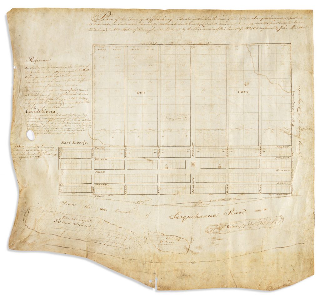
The humble beginnings of a humble town are modestly affordable; if what we’re offering here was something comparable to say Cincinnati, or Pittsburgh, or Harrisburg, the value would be almost inestimable. But not every eighteenth-century American river town turned into a metropolis. There is however something satisfying, even a little bit precious, knowing that so little has changed there in Mifflinville in the 225 years since this layout was drawn up.
Discover More Exciting Finds on Offer
A Panorama of New York City
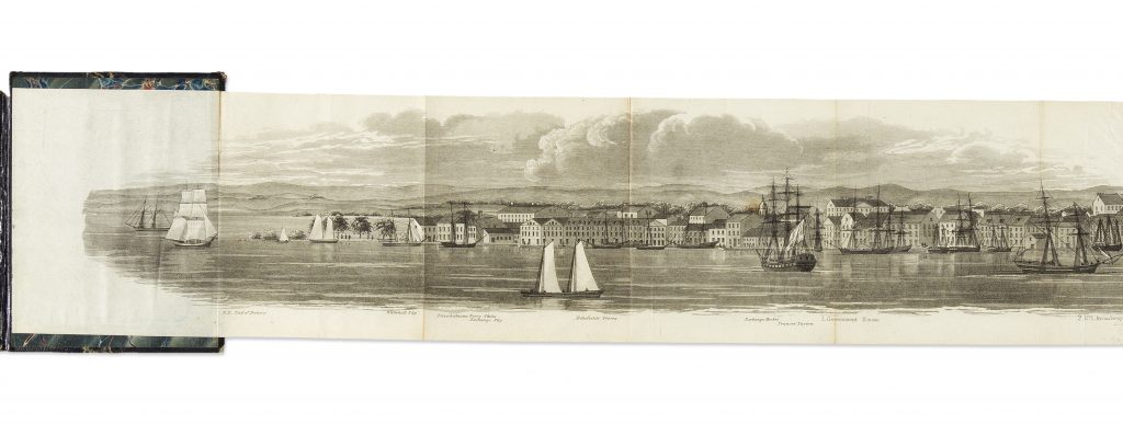
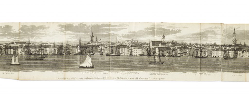
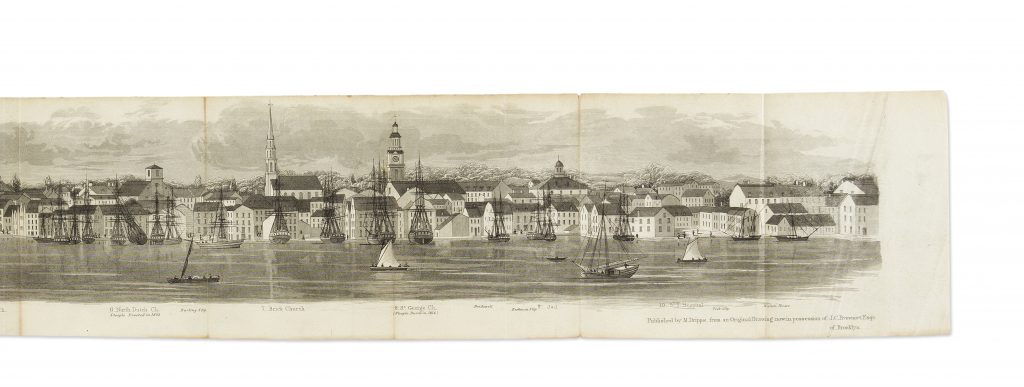
Something else I adore (and feel is quite undervalued) is lot 389, a panorama of New York City printed in the mid-nineteenth century after a 1798 drawing by Charles Balthazar de Saint-Memin. The delicate view is almost five feet long but a diminutive four-and-a-half inches tall and folds into an original metal cover case stamped with the Seal of the City of New York in gold. This example is an uncommon separately issued version of the print published by Matthew Dripps circa 1850-1860, and not taken from a D.T. Valentine’s Manual where it was later proliferated to a broader audience. It’s just a charming little gem and the condition couldn’t be better.



![Grace Meschery-McCormack shares about two copies of Fernando de Rojas’s ‘La Célestine,’ including a limited edition copy illustrated by Pablo Picasso.
At auction April 22. Learn more about the works at the link in our bio.
#Rarebooks #rarebookdealer #antiquarianbooks #auctions
_______________________________________
Music Credit:
Schubert - Piano Quintet in A major ‘The Trout’, D. 667 - IV. Andantino – Allegretto
Music provided by Classical Music Copyright Free on Youtube [https://tinyurl.com/visit-cmcf]
Watch: • Schubert - Piano Quintet in A major ‘...]](https://scontent-iad3-1.cdninstagram.com/v/t51.75761-15/491443494_18499096345036585_5935932878956098058_n.jpg?stp=dst-jpg_e35_tt6&_nc_cat=107&ccb=1-7&_nc_sid=18de74&_nc_ohc=m-4Ir9scQRgQ7kNvwF0EC_d&_nc_oc=Adk6vWHvJMH5TK67zw75jTpjO3KqV6u2qJzpfUwC4bmSaYLGiSmw5xfkUuplusJ5mI8&_nc_zt=23&_nc_ht=scontent-iad3-1.cdninstagram.com&edm=AM6HXa8EAAAA&_nc_gid=sh2dz65Krik12HDto7qYsA&oh=00_AfGDXGVC52I1qrum2bk-qwQlvAmSB7a8DH0UR4j2eL4KtQ&oe=680B14D1)


