Lewis Evans: An Overview of Creating ‘General Map of the Middle British Colonies in America’
Lewis Evans’ General Map of the Middle British Colonies in America was one of the most significant and influential maps published in Colonial America. On it, Evans described the land beyond the British frontier into the Ohio territory with great amounts of new information, offering potential settlers, speculators and military officials the most detailed and accurate look at the lands to the west that had not previously been printed on a map.
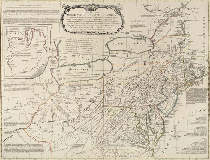
The map was so widely accepted and approved by the contemporary audience that it was republished and translated into numerous languages throughout the remainder of the eighteenth century.
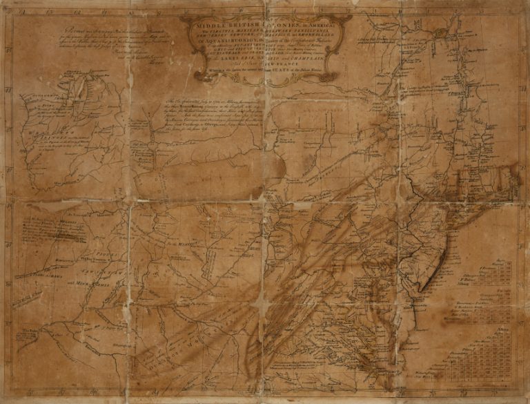
Our sale of Maps & Atlases, Natural History & Color Plate Books in June 2019 featured a rare piece of this historical map’s publication story, offering a unique opportunity to be a part of Evans’ decision-making process as he annotated and edited the working proof-copy, cultivating his map towards its final state. The map more than doubled its pre-sale estimate of $30,000 to $50,000, bringing $125,000.
May 2, 1755
The present map was struck from the plate as a working proof-state, nearly 75% complete, allowing the maker to evaluate its progress. The general cartography is laid down, but the finishing details are all lacking, most notably Evans’ own engraved name, the engraver Benjamin Turner’s name, cartouches and insets, tables, anecdotes and the publishing imprint. Virtually all the major place names and toponyms seen on the finished map do not appear.
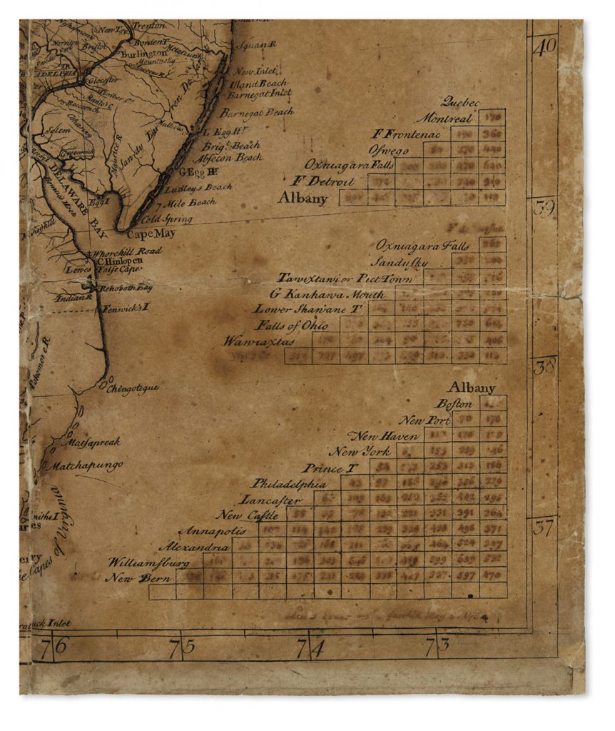
Evans has written several of these names and filled the distance tables at lower right in manuscript to be engraved, giving a sense of the cartographer’s working process. Below the tables is an ink signature: “Lewis Evans … May 2, 1755”.
Caleb Kiffer:
“Here we have the maker of an eighteenth-century American map literally signing off on the work-in-progress printing of his map, which would go on to have historic implications, 53 days before it was finished and ready for official publication on June 23rd, 1755. It is an artifact as much as it is a map, the sort of item generally deemed impossible, or at least improbable to survive to modern times. Yet this unlikeliest of documents has now surfaced, yea for the appreciation of students and scholars of cartography, American Colonial history, and printing processes.”
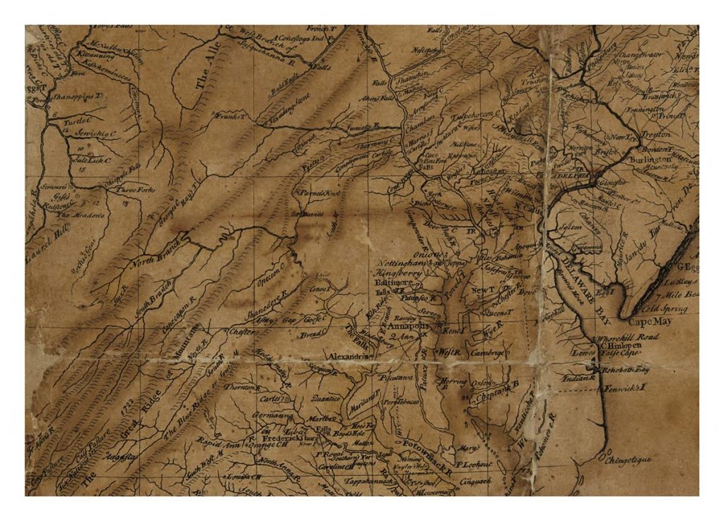
In June 2017 the house offered the first major map published by Evans: Special Land Charte von Pensilvanien, Neu Jersey, Neu York, 1750, detailing the east coast area after his trip in 1743. He would go on to publish A General Map of the British Colonies in America 12 years later.



![Grace Meschery-McCormack shares about two copies of Fernando de Rojas’s ‘La Célestine,’ including a limited edition copy illustrated by Pablo Picasso.
At auction April 22. Learn more about the works at the link in our bio.
#Rarebooks #rarebookdealer #antiquarianbooks #auctions
_______________________________________
Music Credit:
Schubert - Piano Quintet in A major ‘The Trout’, D. 667 - IV. Andantino – Allegretto
Music provided by Classical Music Copyright Free on Youtube [https://tinyurl.com/visit-cmcf]
Watch: • Schubert - Piano Quintet in A major ‘...]](https://scontent-iad3-1.cdninstagram.com/v/t51.75761-15/491443494_18499096345036585_5935932878956098058_n.jpg?stp=dst-jpg_e35_tt6&_nc_cat=107&ccb=1-7&_nc_sid=18de74&_nc_ohc=Z9JEGkAXHREQ7kNvwGGUot6&_nc_oc=AdmJSnx8eY0WSW4ZCrMwPTmQIsTfafOSyYaXtUeWluHXKdvbxi2gWaQXyIMLUy6-JA4&_nc_zt=23&_nc_ht=scontent-iad3-1.cdninstagram.com&edm=AM6HXa8EAAAA&_nc_gid=P1eFwx-9vkiPIpecf8UvRw&oh=00_AfEn3dlYapEGq3gBXFRaoVg4co6MBMu1D2FzA2ndaV8Cjw&oe=680871D1)


