The Endless Mountains: A Map That Promised More
Specialist Caleb Kiffer of our Maps & Atlases department on one of his favorite pieces in our June 7 auction of Maps & Atlases, Natural History & Color Plate Books: a 1750 map of Pennsylvania that may have sparked German emigration to the state.
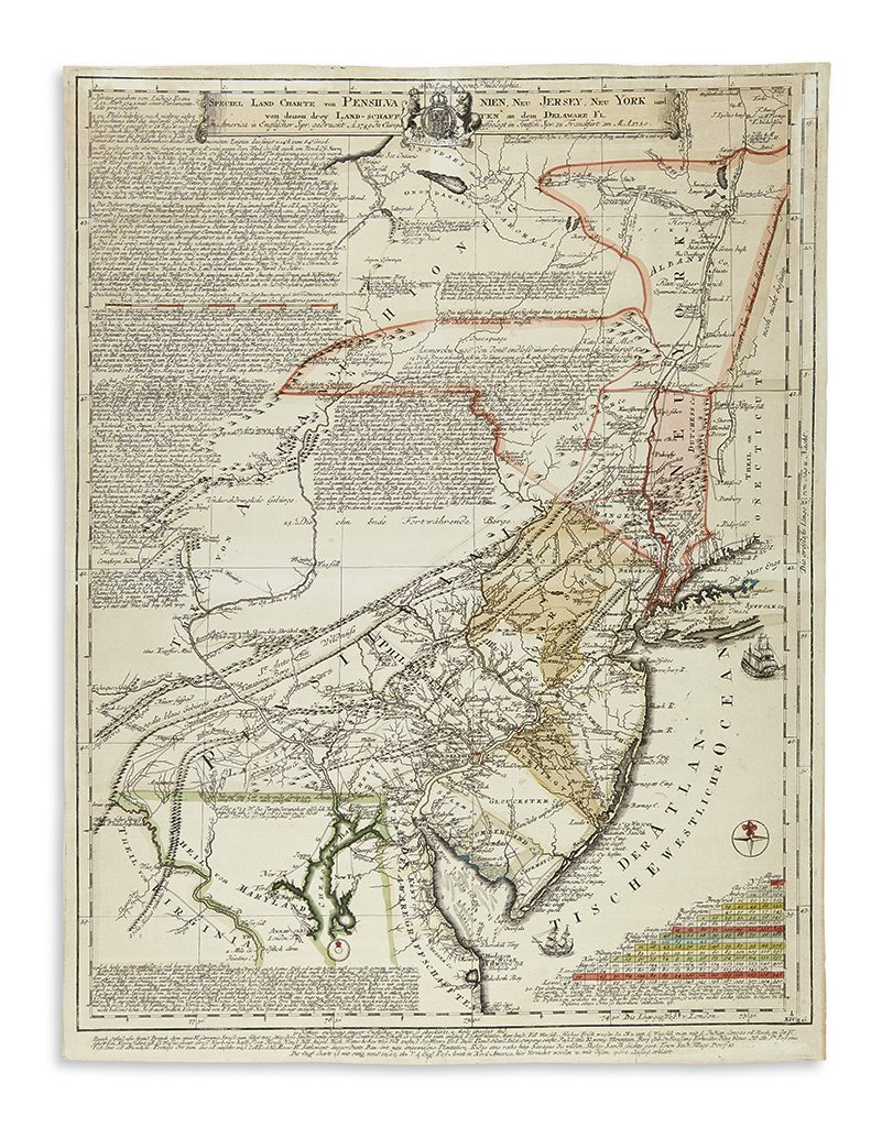
Lot 60: Lewis Evans, Speciel Land Charte von Pensilvanien, Neu Jersey, Neu York, Frankfurt, 1750. Estimate $10,000 to $15,000.
In 1749, Lewis Evans, America’s greatest eighteenth-century cartographer, published his first major map titled A Map of Pensilvania, New-Jersey, New-York, and the Three Delaware Counties. This extremely scarce map was published in Philadelphia and details the area described in the title, providing what minimal cartographical knowledge of the interior lands there was. Part of the information was compiled by Evans himself during a trek through the region in 1743. In the center of the map appears a bold, frightening, yet tantalizing statement: The Endless Mountains. Line after line of engraved comments and anecdotes relating to the land, weather, rivers, safe routes of passage between already established towns and places populate the empty spaces of the map.
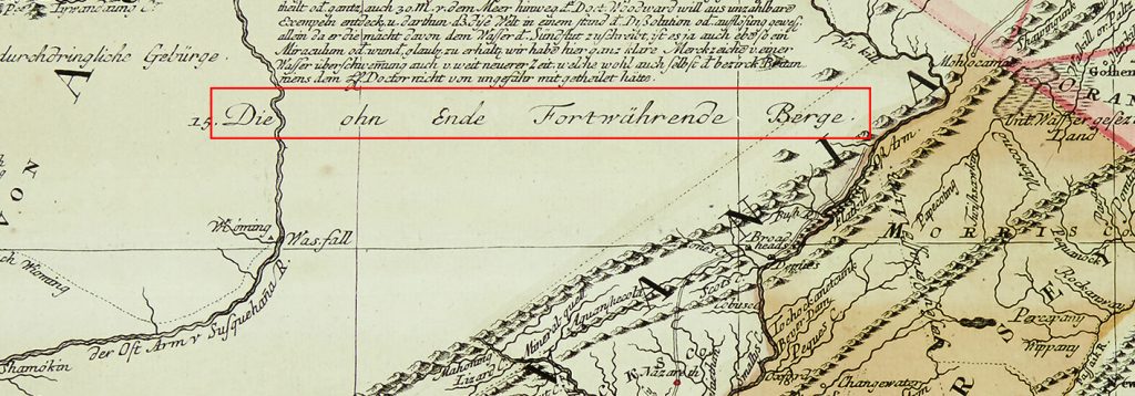
Detail showing “Die ohn Ende Fortwährende Berge” – “The unending mountains”
As put by Seymour Schwartz in The Mapping of America: “Furnishing the first detailed coverage of such a large colonial area, the map of course has great importance.” A trait that truly makes an early map important is: did it have an impact on people? Did a map of a far away, unknown, “endless” new country cause somebody to become inspired to move there from across the ocean? In this case, yes. And what people composed such a huge swell of immigration to this particular area at this particular time? The Germans. The Pennsylvania Germans.
Also known as the Pennsylvania Dutch due to their name for their language (Deutsch), the population still exists today in one of the oldest and largest Amish communities in the country.
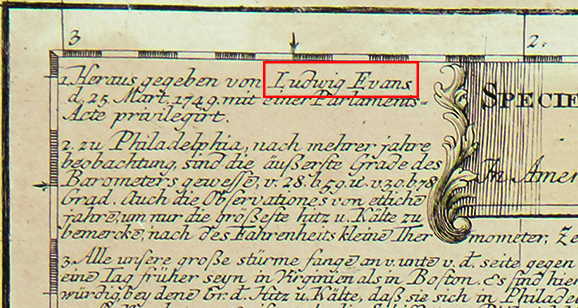
Detail showing Lewin Evans’s name as “Ludwig Evans”
The map presently being offered was published in Frankfurt, Germany in 1750, a year after Evans’ first map appeared. It is an edition for which only one other extant copy can be located, in the Library of Congress. Lewis Evans’ name is given as “Ludwig Evans” on the map. The cartography is faithfully copied and unchanged, while every name of every town, river, mountain range, Indian tribe, and each letter of those long lines of descriptive and potentially alluring text has been painstaking re-engraved from the English to German. Somebody in Germany got hold of a copy of Evans’ map and took to the laborious task of re-engraving the entire thing, thus making it available to an audience primed to take that step to set out and change their lives for the promise of a new and better life. All it would’ve taken was a push; all it would’ve taken was a look at this map.
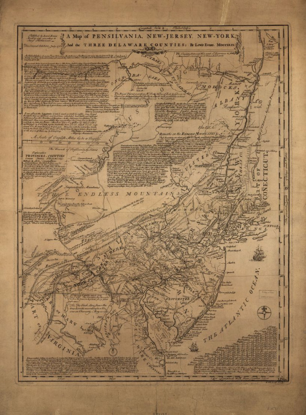
Lewis Evans, A Map of Pensilvania, New-jersey, New-York, and the Three Delaware Counties, 1749. Courtesy of the Library of Congress.
As Evans notes on the map: “This country is finely improved to the mountains; and the inhabitants enjoying the fruits of the difficulty of first settling. The roads are very well accommodated. Here opportunity and materials are never wanting to furnish the industrious with profusion. It is a country of Liberty and good laws, where justice is administered without rigour or partiality.”
Find more in the full catalogue.
